Tuesday, April 19, 2011

DESPERATE TIMES, DESPERATE MEASURES

Being that the TX panhandle has been so dry and void of storms this year, it has been a very frustrating chase season, without a doubt. It's past mid April, and until today, I've only been on 3 chases, and one was a huge bust. With a bit of energy coming over the Northern TX Panhandle, and Td's in the upper 30's and lower 40's, a few thunderstorms were forecast for this region. They weren't going to be severe, but at this point, I didn't care! I just wanted to get out of the house and see something! The 4km WRF put a decent cell near Stratford by mid-day, and that's what I was banking on. Stratford, TX, here I come!

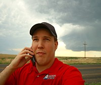
I left about 2:30 or so, and made it up to Stratford a little after 4. I saw a few towers to the W/NW, so I parked just north of town and watched for about an hour. A cell west of Stratford got going, and actually became severe when it reached Spearman. It was moving too fast for me to catch, so I resumed watching the storms to my NW. After a few minutes the storms showed somewhat of a base. They were moving SE, so I scooted south of Stratford on hwy 287. As was talking on the phone to John Harris, I noticed a quick forming mid level funnel, and I got a quick shot of it with the iphone. The funnel lasted no more than 30-40 seconds. The base became a bit more defined, and I took a few more pictures and called it a day.

Couldn't expect more on a day with such low expectations. I still love low risk days! They seem to like me a lot! Now to the photos:

PHOTO #1 Storm near Stratford that eventually became T-storm warned near Spearman, TX
PHOTO #2 Mid-level funnel on left side of updraft near Stratford, TX (iphone photo)
PHOTO #3 Updraft near Stratford a few minutes after mid-level funnel
PHOTO #4 Decent structure of T-storm base near Stratford, TX
PHOTO #5 Base beginning to dissipate, but still pretty decent structure near Stratford, TX


Tuesday, April 5, 2011

3/24/11 CHASE NEAR LAMESA, TX

I had been eyeing this day for a couple of days and decided to pull the trigger to chase. It wasn't going to be a huge day, but it had potential. I left home about 12pm and targeted Lamesa, TX. I got a text and found out that my buddy David Drummond was just south of Lamesa at a rest stop. I finished lunch (Subway) and headed that direction. We met and shot the bull for about 30 minutes and saw towers going up near Midland. We decided to head that way, but after about 10 minutes on the road, the cells died out quickly. We decided to head back to the rest stop and continue to wait it out. After about 30 minutes or so, towers started forming to our south and southeast. We waited a few minutes and decided to go after them. We went east on 180 and made it into Snyder. We decided to get gas since towns are fairly sparse in the area. We looked at radar and the storm was severe warned. It didn't look too bad visually, but it had a fairly high base. We then decided to go north towards Rotan. We sat about 10 miles West of Rotan and watched the storm for quite a while. We saw plenty of CG's, and actually saw a fire started from the lightning. The storm looked ok but never really got it's act together. As light faded we decided to go into Rotan to see if the storm had dumped any hail in town. As we were looking at the storm to the SE, a farmer came over and started talking to us. He mentioned food and our faces lit up with enthusiasm. Right across the street from where we had parked was a nice little barbecue joint. We went in and were treated to some great sausage and brisket with some pinto beans and sweet tea. After that, we chatted a bit, and then I made the long trek back to Amarillo. All in all, it was a great chase, and I had fun chatting and chasing with David.

PHOTO #1: David Drummond's chase vehicle in foreground near Rotan, TX
PHOTO #2: An old abandoned storm shelter near Rotan, TX
PHOTO #3: Treated to an amazing sunset near Rotan, TX


3/19/11 CHASE NEAR PLAINVIEW, TX

Started off the day at the NWS convention at the Amarillo Civic Center. Had lots of fun with the guys from the station and my chaser buds. It looked to be a possible chase day with Td in the 50's and a warm front hanging around the area. I stayed at the Civic Center until about 2:30 or so and then went home to take a short nap. That was my mistake. I got back up and saw convection SE of Plainview and scrambled to get to that area. A tornado warning was issued for the cell that was SE of Plainview, but I was just too late in getting there. I made it south of Plainview and saw the storm that initially had the tornado warning on it. It still had a pretty well defined wall cloud with it, but the light was fading fast. I then went back to Plainview and found a nice spot to watch the rest of the convection move to the north. All in all, it was great to get out for the first time in 2011 and see some convection and CG's which really helped with the SDS that I had acquired over the long winter months!

PHOTO #1 and #2: Convection near Plainview, TX


Sunday, February 6, 2011

SOME SNOW

We finally got a few inches here in Amarillo. Actually, about 2-3 to be exact. This will definitely help with the wildfire concerns this year, but we need more. Went out and did a little snow driving in the Xterra for the first time this winter season.

Monday, December 20, 2010

YES, I'M ALIVE AND WELL!

First of all, yes I'm alive and kicking!
Second of all, Jay McCoy said I need to update the blog, so this one's for you Jay!

It's been a dull winter around here! Two little snow events not really worth talking about, and that's about it. I'm not the type that posts about everything that goes on in my life, and even then, it would be pretty dull! Anyway, I've just been doing a little vehicle maintenance lately to get ready for 2011. Also, I got a filmtools window mount for my vid camera, so now I'll have more video in the coming season. I guess Facebook has taken over the majority of my posts, but I promise that I will have wx images on here as well as Facebook. I'm in no way giving up this site for Facebook...that's a promise.

Anyway, now that you know I'm alive, you can sleep better tonight! LOL

Friday, June 4, 2010

SORRY FOR THE LACK OF POSTS LATELY

Whew!!! I have been busy chasing lately among other things. I finally got this blog updated. For those that follow me, I apologize for not being more consistent in my posts. For those of you that chase and maintain a blog, you know how hard it can be to stay current.

Now, enjoy my recent chases and photos from the past couple of weeks!

5-31-10 MEMORIAL DAY MIRACLE CHASE IN COLORADO!!!

All I can say is WOW!!! ABSOLUTELY THE BEST CHASE OF MY 12 YEAR CAREER!

Another slight risk and t-storm watch did it for me again! Boy, I'm still all giddy inside! Met up with friend Dan Skoff in Guymon, OK and he left his vehicle and jumped in with me. We actually targeted Campo, CO (believe it or not). Got west of Campo and saw a brief funnel (later found out it was a tornado). The storm looked ok, but never really looked like it was going to put down a significant tornado. We found out differently after we got south of Campo a few miles. We were actually looking at rotation SE of Campo. We pulled over and I happened to look to my NW and saw the long funnel touch down about a half mile or so to our W/NW. It was coming straight at us, so we had to blast south a little ways to get out of the path. At times, we got hit with RFD winds of at least 75-80 mph and maybe higher. We followed the storm to Guymon and saw at least 3 more tornadoes as we followed it back. In 12 years of chasing, it's the best chase of my life. Being a chief met in Fayetteville, AR, Dan hasn't seen a good daytime tornado in 10 years. That came to an abrupt ending today! Everything went absolutely perfect for us today. I took all stills of the event, and Dan took the video. This is the best tornado I've ever seen! Oh, and it's the first tornado I've ever seen in Colorado.

Tornadoes like this make all the negative factors of storm chasing worth every minute.

EDIT: Forgot to mention that is was absolutely great to finally meet Lou Ruh and Dr. Jason Persoff. 2 very genuinely nice guys that make a storm chase even better! Like I've said before...tornadoes are great, but meeting awesome people on a chase is something I'll always cherish.


PHOTO #1 DAN SKOFF GETTING VIDEO OF THE STORM WEST OF CAMPO, CO
PHOTO #2 ANOTHER PERSPECTIVE FROM DAN SKOFF
PHOTO #3 DAN SKOFF POSING WITH A NICE LOWERING WEST OF CAMPO, CO
PHOTO #4 THE FIRST THING IS SAW WHEN I LOOKED TO THE NW. I BARELY GOT IT OUT, BUT I SAID...DAN A TORNADO. I REALLY COULDN'T BELIEVE IT.
PHOTO #5 IT GOT BIG VERY QUICKLY. TAKEN ABOUT 3 or 4 MINUTES AFTER THE FIRST TORNADO SHOT.
PHOTO #6 PROBABLY THE BEST WEATHER PHOTO I'VE EVER TAKEN. I CAN'T THINK OF ONE THAT TOPS THIS ONE. JUST A CLASSIC TORNADO PHOTO IF YOU ASK ME.
PHOTO #7 TORNADO AS IT'S PICKING UP A LOT OF DIRT AND CROSSING THE HIGHWAY
PHOTO #8 A RARE PHOTO OF A TORNADO AND RAINBOW IN THE SAME FRAME


5-25-10 REPORT

Started off the chase near Hereford, TX and made it north to Channing where a storm showed promise. Some other storms from the south merged with the isolated storm and basically killed it. Zoomed the radar out and noticed a tornadic storm west of Dimmitt, TX. Blasted south and got a brief tornado, and a couple of hours later the cell morphed into a spectacular LP north of Nazareth. A brief tornado and a beautiful LP at sunset...you just can't beat that.

PHOTO #1 STRIATED UPDRAFT WEST OF CHANNING, TX
PHOTO #2 BRIEF TORNADO WEST OF DIMMITT, TX
PHOTO #3 BEAUTIFUL LP SUPERCELL NORTH OF NAZARETH, TX


5-24-10 REPORT

I didn't nab any tornadoes today, but I still got some great photo ops. Started off near Pampa, TX with Bri Winkler and Will Coffin, as we worked our way down to Lefors, TX. Got south of town and had a great wall cloud develop and showed signs of rotation, but it never dropped a tornado. Fiddled up near Canadian, TX for a while and made the trek back home. On the way home, I decided to go south out of Pampa to catch a few photos ops of a storm at sunset. I wasn't disappointed at all. No tornadoes, but it was still a great day with some great photos to take home.


PHOTO #1 LARGE WALL CLOUD SOUTH OF LEFORS, TX
PHOTO #2 ANOTHER SHOT OF WALL CLOUD SOUTH OF LEFORS
PHOTO #3 NICE LOWERING SOUTH OF CANADIAN, TX
PHOTO #4 NICE SCULPTED UPDRAFT WITH MAMMATUS ON HWY 70 NE OF GROOM, TX
PHOTO #5 ANOTHER SHOT OF SCULPTED UPDRAFT
PHOTO #6 BEAUTIFUL ANVIL COLORED BY THE SETTING SUN NE OF GROOM, TX


5-21-10 REPORT

Got on the storm SW of Groom, TX after traveling with Jay McCoy for the first part of the day. Got to photograph some incredible structure. What a day! I absolutely love TX Panhandle LP Supercells!!! Most shots from North of Clarendon, TX looking west. The last one is near Groom, TX. This was the most photogenic LP supercell that I have ever seen. Not only was the structure beautiful, but the fading sun behind the storm gave it special character that has made it one of the top storm photos that I've ever taken (PHOTO #2).

I did meet up with Brady Kendrick, Marcus Diaz and Steve Miller(TX) south of Groom to try to see some large hail. Earlier on, the storm produced hail that was about the size of softballs. When I got there (over an hour later) they were still the size of golf balls. Of course LP's are prolific large hail producers, and this one was no different.


5-19-10 REPORT

First of all, congrats to those who scored today...I didn't fare so well. Left Amarillo late because I was at the tv station in Amarillo helping with cut-ins (I ran the studio camera) until 4am. I got up late, but met Bri Winkler at the station at 1:30. We took off and just jetted east on I-40 to make up some time. Never got in great position to see any tornadoes, but we did see some nice structure that was worth the price of admission. I'm one that doesn't have to see tornadoes to be satisfied with a chase. If I was, I'd be disappointed quite often. I can say this...at least I got out and tried, and to me it wasn't a bust. Anyway, enough of my boring summary...now to the photos! :-)

EDIT: Almost forgot to mention this. There was a lot of talk about certain individuals driving crazy on this day in Oklahoma. I had a special guest in my home that did a short talk about the antics of this day. I think you'll enjoy it!

CLICK HERE FOR INTERVIEW

PHOTO #1 SUPERCELL LOOKING NORTH FROM CLINTON, OK
PHOTO#2 SAME STORM AS PHOTO #1, BUT ABOUT 20 MINUTES LATER
PHOTO#3 SEMI TURNED OVER FROM A TORNADO NORTH OF KINGFISHER, OK
PHOTO#4 LOOKING SOUTH AT A STORM FROM WATONGA, OK
PHOTO #5 ANOTHER PHOTO LOOKING SOUTH FROM WATONGA, OK


5-18-10 REPORT

Hung out at the tv station until things got going. It looked pretty good for severe storms so we were ready to go. Saw a storm firing west of Dumas and headed that direction with my current chase partner Bri Winkler. As we got closer to Dumas, we began to see features of the storm to our southwest. We stopped about 10 miles south of Dumas to get a glance, and it had already produced a decent rain free base and small wall cloud. We got to Dumas and headed west of town to get a better view. It looked really good. It had a large wall cloud with a tail cloud to boot. We waited and watched a few minutes and I decided to go south about 3 or 4 miles. We got a good perspective and it looked pretty good. After a while, the updraft began to get filled in with rain, and it took on more of an HP status. We continued to watch it as Warren Faidley pulled up beside us and chatted for a while.

We watched the cell slowly drift toward Dumas as the rotation got wrapped in rain. We could see some rotation on the back side, and we thought we may have seen a wedge develop for a brief time. We decided it was just a very low hanging wall cloud. If it had indeed been a tornado, Dumas would have had their hands full. We went east of Dumas for a while but were caught on the backside of the storm. Besides, the storm was drifting into an area with very poor road options. We broke off the chase at this time and hoped storms might form further south near Amarillo. That never happened, but it was a great chase nonetheless.

PHOTO #1 LARGE WALL CLOUD SOUTHWEST OF DUMAS, TX
PHOTO #2 STORM FEATURES WEST OF DUMAS, TX
PHOTO #3 UPDRAFT OF STORM FILLING IN WITH PRECIP
PHOTO #4 WARREN FAIDLEY'S CHASE VEHICLE. THE PERSON STANDING THERE WAS NOT WARREN. I THINK IT WAS ONE OF HIS TOUR CUSTOMERS.
PHOTO #5 RAGGED ROTATION JUST WEST OF DUMAS, TX


Thursday, May 13, 2010

5-12-10 REPORT

I got a late start to the day and tried to catch the cells coming from the Paducah Quanah TX area heading into Altus, OK. I wasn't able to succeed in that attempt and headed back west to get on the cells in the SE TX Panhandle near Memphis. Got a pretty good wall cloud with some rotation which tried to produce a tornado a couple of times and failed.

Saw Steve Miller TX in his new vehicle and we talked a few minutes. We headed towards Hollis, OK after a tornado warned cell. I headed north of Hollis and had a few attempts at wall clouds, but the storm just never did it for me. It looked really good nonetheless. Piddled around taking a few photos and saw some vortex2 equipment on the side of the road and decided to take some stills of the equipment with the storms in the background. Headed to Sayre and made the trek back home. No tornadoes today, but it was still a great day of chasing! Now to the photos:

PHOTO #1-Storm south of Memphis, TX
PHOTO#2-Anvil associated with the above image
PHOTO#3-Broad rotation north of Childress, TX looking west
PHOTO#4-Storm north of Hollis, OK
PHOTO#5-Photo north of Reed, OK
PHOTO#6-Small wall cloud north of Reed, OK
PHOTO#7-Another shot north of Reed, OK
PHOTO#8-Near Willow, OK
PHOTO#9-VORTEX2 equipment with storm in background southeast of Sayre, OK
PHOTO#10-Same as above
PHOTO#11-Looking towards Cordell, OK
PHOTO#12-Same as above, but different angle
PHOTO #13-Final shot of VORTEX2 equipment with storm